")
")
The zoning of the proposed Reserve is according to projection system WGS84 that defines the boundaries of the three zones of the Biosphere Reserve, reflecting the three distinct recommended functions of the Biosphere Reserves of the MAB UNESCO Programme.
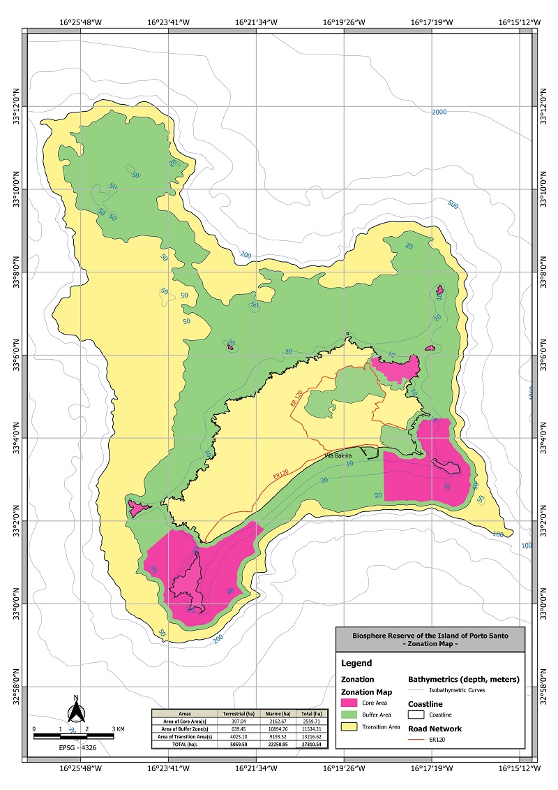
Zonation of the Biosphere Reserve of the Island of Porto Santo, according to projection system WGS84 (EPSG:4326).
CORE AREAS
Two types of Core Areas were considered in the proposed Biosphere Reserve: Core Terrestrial Area and Core Marine Area.
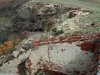
The Core Terrestrial Areas of the proposed Reserve coincide with ZEC PTPOR0002 (Special Area of Conservation – Pico Branco, Porto Santo) and ZEC PTPOR0001 (Special Area of Conservation – Islets of Porto Santo). The Core Marine Area includes the surrounding area of the Islet of Cal and Islet of Cima which corresponds to the marine area of the Network of Protected Marine Areas of Porto Santo (RAMPPS).
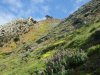
In relation to ZEC PTPOR0002, the Programme for Management and Conservation Measures of the Natura 2000 Network Site of Pico Branco – Porto Santo (PTPOR0002), includes the implementation of policies for the management of forest resources and natural areas of Pico Branco, in a territorial land area of 135.5ha (which includes the Core Forest Terra Chã which is 17.5ha), centred on the demand for the defence and enrichment of the natural heritage, based on the sustainable management of the protected natural space, in a micro-reserve approach, by monitoring and restoring the populations of the existing endemic taxa. Pico Branco is one of the only places in RAM where a priority forest habitat under the Habitats Directive, designated as endemic Forests with Juniperus spp can be found and to which other typical Macaronesian habitats and species of flora and fauna, included in Annexes II or IV of the Community directive and the Birds Directive, can be added. It hosts flora and fauna taxa exclusive to Porto Santo or even to Pico Branco, of considerable conservational interest. Management and conservation measures of Pico Branco include the adoption of strategic and specific objectives, and the development of actions or measures conducive to the environmental protection of the Site. Its main strategic pillars are the conservation of nature and environmental protection and it encourages participation of the population and visitors in the enjoyment, promotion and preservation of the natural space. The main objective of these actions is the recuperation and maintenance of the natural vegetal cover, promoting their development in areas which are more susceptible to erosion by appraising the components of the soil and the reduction of the impact of erosive phenomena on the landscape; the protection of the biodiversity and the landscape; the conservation of fundamental assets like the soil and the water; the monitoring and enrichment of knowledge of the biodiversity; the improvement or maintenance of the conditions of access to the natural spaces, managing the activities of the use of the space and implementing actions that lead to the diffusion and promotion of the natural, cultural and landscape heritage of the area.
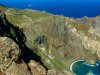
In terms of terrestrial area, RAMPPS is made up of the six islets–Cal or Baixo; Cenouras; Cima, Dragoeiros or Farol; Ferro; Fonte da Areia; and Fora or Rocha do Nordeste – and the marine area surrounding the islets of Cal and Cima. RAMPPS includes areas of great natural value, which implies different levels of protection and, as a consequence, permission for different activities, namely educational, scientific or even economical, such as non-commercial or recreational sea fishing, the picking of limpets and snails from the pebbles, scuba diving, spearfishing, maritime tourism and nautical activities, in accordance with the restrictions of the use of the soil or the territory established on POGRAMPPS.
The Core Area corresponding to RAMPPS– ZEC PTPOR0001 ‘Islets of Porto Santo’ – includes areas that have been classified according to the levels of ‘Area of Total Protection’ and ‘Area of Partial Protection, Type I’.
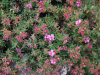
The ‘Area of Total Protection’ – which covers the Islets of Ferro, Fonte da Areia, Fora and Cenouras – corresponds to an area of high ecological and biophysical value, it is very sensitive to human activity or has a poor regenerating capacity, making all its natural values subject to full protection and recommending the safeguard and conservation of the values of flora and fauna and their respective habitats. This level of protection that covers the indicated islets stems from the interest in safeguarding a natural heritage that ranges from the geological aspects to the species of xerophytic, indigenous and endemic vegetation, and faunal species, namely sea birds.
The area of partial protection corresponds to the areas of ecological value, where human activity is compatible with the heritage, natural and cultural values.
In the area of Partial Protection, Type I, the use is conditioned, favouring activities that fall within the scope of conservation and appreciation; actions which promote and raise environmental awareness, scientific studies and papers and recreational and leisure activities, guaranteeing the safeguard of environmental balance. They are areas of ecological value where human activities are compatible with the heritage, natural and cultural values. In the area of Partial Protection, Type I – which includes the Islet of Cima and the Islet of Baixo or Cal – some of the natural elements are included in the protection, so human activity is conditioned, safeguarding the protection of the existing natural values. In the area of Partial Protection, Type II – non-commercial or recreational fishing, picking limpets and snails from the pebbles, scuba diving, spearfishing and some maritime tourism and nautical activities are allowed in the marine area surrounding the Islets of Baixo and Cima.
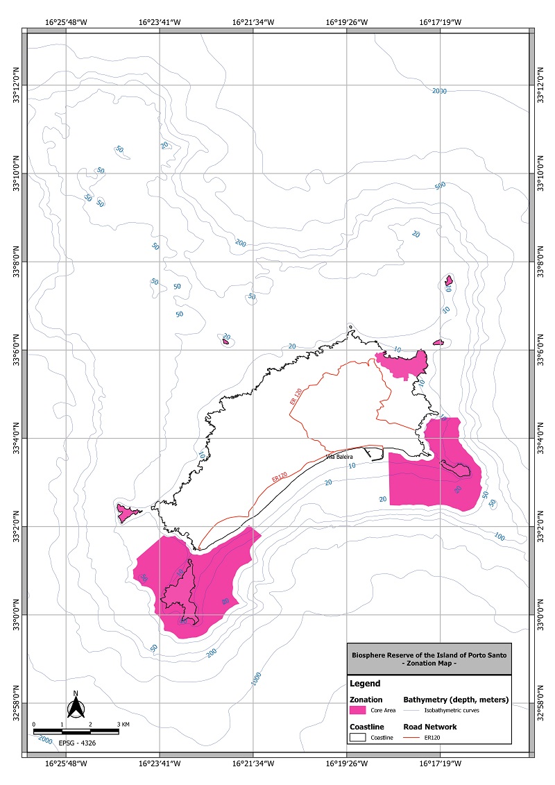
Core Areas of the Biosphere Reserve of the Island of Porto Santo, according to projection system WGS84 (EPSG:4326)..
BUFFER ZONES
The Buffer Zones make up an area with the dimensions and legal status, in terms of nature conservation and biodiversity, necessary for the protection functions of the Core Area. The definition took into consideration the legal status which has already been established and the topographical and functional aspects which guarantee functional continuity between the Core Areas and the Transition Areas.
The marine area borders the land area of the Island of Porto Santo and the surrounding areas to the core areas established for the different islets, from the 50m bathymetric line. Some activities such as nautical and maritime tourist activities, extensive commercial and recreational fishing, picking limpets and snails, diving and spearfishing are allowed here.
The terrestrial area includes the adjoining zone of the marine area of RAMPPS belonging to the Islet of Cima and the strip that borders Pico Branco – Porto Santo (PTPOR0002) and extends along the mountain range in the direction of northeast to southeast, regulated in accordance with PDM of Porto Santo and in conformity with the underlying principles of the Law on Forest Policy – Law No. 33/96), of 17th August and the norms of silviculture defined in PROF-RAM, approved by Government Council Motion No. 600/2015, of 11th August.
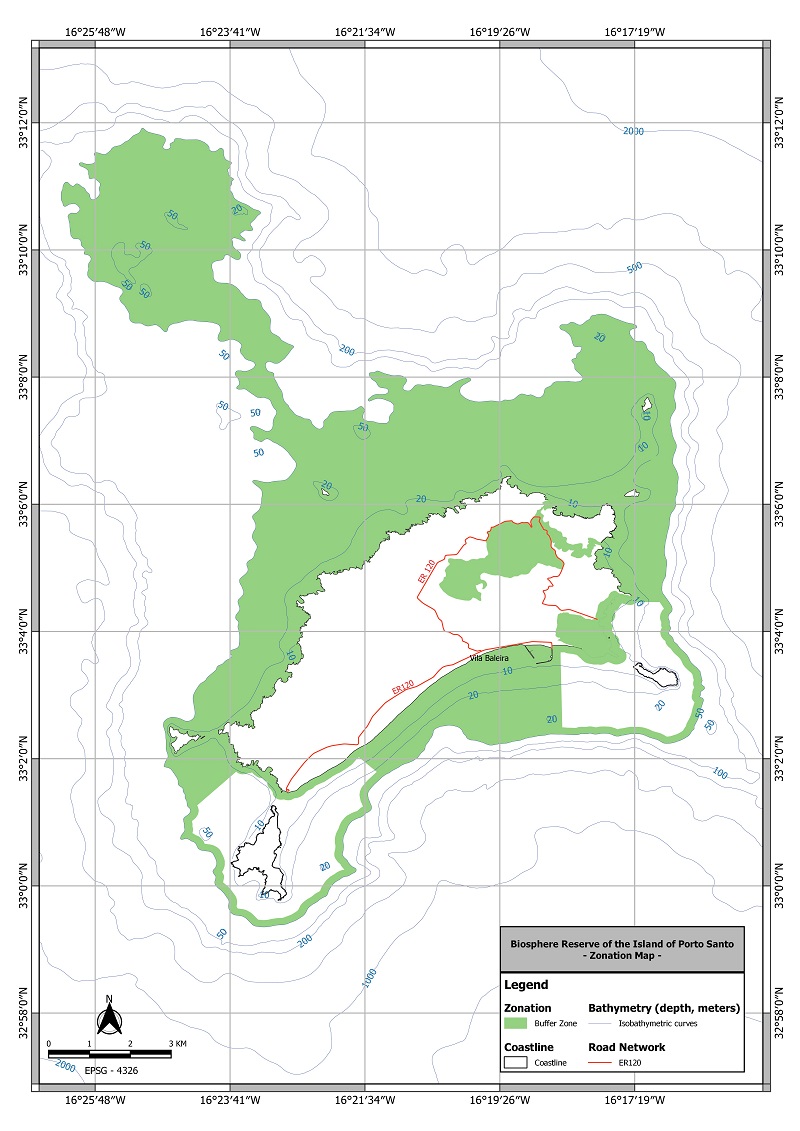
Buffer Zones of the Biosphere Reserve of the Island of Porto Santo, according to projection system WGS84 (EPSG:4326).
TRANSITION AREAS
In the proposed Biosphere Reserve, two types of Transition Areas were included: Terrestrial Transition Area and Marine Transition Area.
The Transition Areas correspond to areas where the different initiatives or business opportunities are essential for the sustainable development of Porto Santo. Given the environmental and sociocultural characteristics that are encompassed in Porto Santo, these zones will decisively contribute to the much desired implementation of the economic and human development objectives, for the Biosphere Reserve, based on the social, cultural and ecological principles of sustainability.
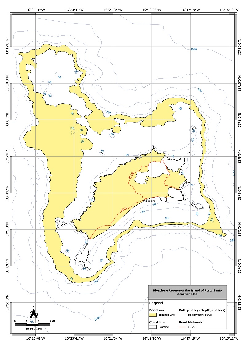
Transition Areas of the Biosphere Reserve of the Island of Porto Santo, according to projection system WGS84 (EPSG:4326).